Hugo Bauer · 9 September 2026
Lumenberg’s Drone Surveys Map Forgotten Urban Green Corridors
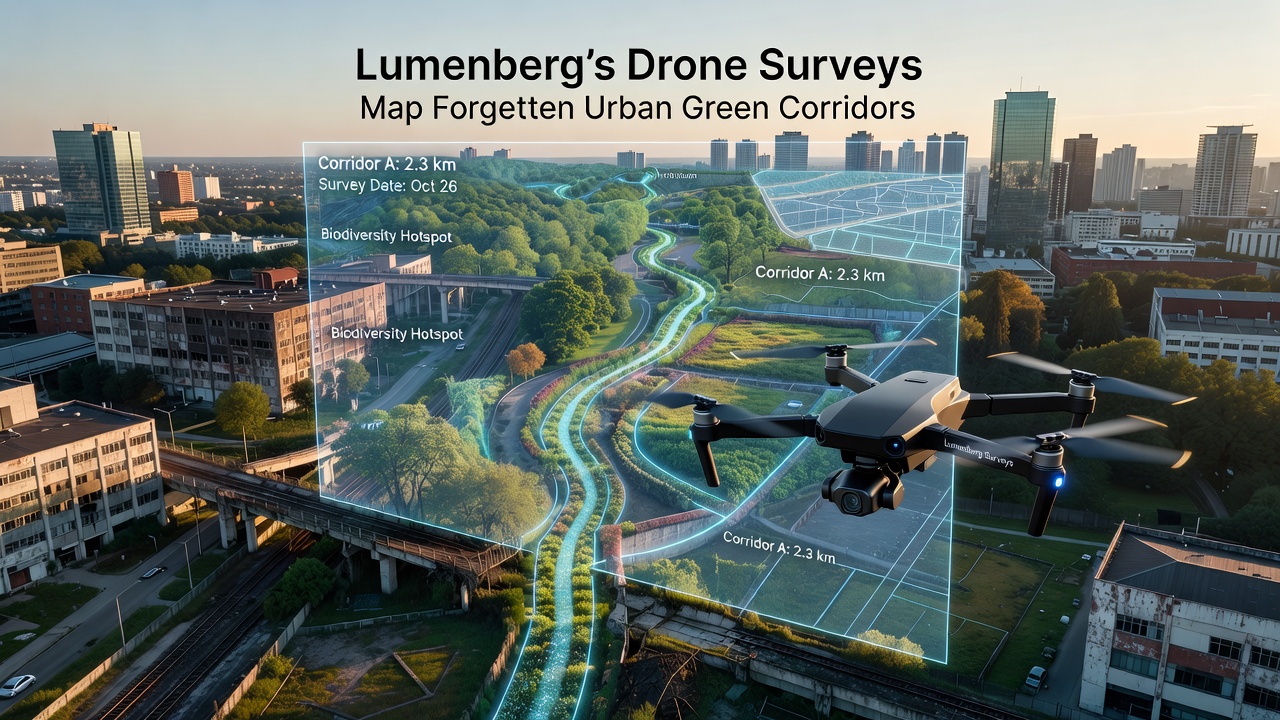
Drone technology has transformed how cities identify overlooked natural spaces, and Lumenberg stands out as one location where systematic aerial surveys have revealed networks of green corridors that planners had not fully documented before. Researchers equipped small unmanned aerial vehicles with multispectral cameras and LiDAR sensors to scan areas along old railway lines, disused canals, and narrow alleyways that run between residential blocks, and the data collected shows patches of vegetation connecting larger parks in ways that ground-level inspections often miss. Those corridors support pollinators and small mammals while offering residents quieter routes for walking or cycling, yet many remained unmapped until the drone flights began.
Survey Methods adn Equipment
Teams from the municipal planning department launched the project in 2024 using fixed-wing drones that flew predetermined grid patterns at altitudes between 80 and 120 meters, capturing overlapping images every two seconds. The flights covered 45 square kilometers of the city’s inner districts, and software stitched the photographs into orthomosaic maps that highlight vegetation health through normalized difference vegetation index values. Observers note that the same flights also recorded elevation changes and canopy density, allowing analysts to distinguish between maintained parks and spontaneous growth along fences or embankments. Because the drones operated under visual line-of-sight rules and avoided no-fly zones near hospitals and the airport, the operation stayed within national aviation regulations throughout each mission.
Key Findings from the Aerial Data
Analysis of the imagery identified 28 previously unmapped green corridors totaling more than 12 kilometers in length. One corridor follows the bed of a filled-in stream that now supports a continuous strip of native grasses and shrubs between two industrial estates, while another runs along the rear boundaries of 19th-century row houses where residents have planted fruit trees over decades. Data shows these linear habitats link the central botanical garden with a riverside wetland on the eastern edge of the city, creating pathways that species such as hedgehogs and certain butterfly populations can use. Figures released by the planning office indicate that 17 of the corridors contain tree cover exceeding 60 percent, a density higher than many designated parklands within the same postcode areas.
Integration with Existing Planning Records
City archivists cross-referenced the drone maps with historical land-use documents and found that several corridors trace the routes of 19th-century market gardens that supplied the old town before suburban expansion. Planners have since updated the official open-space inventory so that future zoning decisions must consider these linear features when approving new construction or infrastructure upgrades. According to reports from the European Environment Agency, similar mapping exercises in other mid-sized European cities have led to protected status for at least a portion of the identified corridors, and Lumenberg officials are reviewing comparable measures.

Community and Ecological Benefits Observed
Local biodiversity groups conducted follow-up field visits in spring 2025 and confirmed the presence of 14 plant species previously recorded only in the city’s larger nature reserves. Bird counts along one corridor showed a 22 percent increase in breeding pairs compared with surveys from five years earlier, and residents who use the spaces for daily walks reported fewer vehicle encounters because the routes stay separated from main roads. Schools in adjacent neighborhoods have begun incorporating the corridors into environmental education programs, with students collecting soil samples and monitoring insect populations during scheduled outings. These activities rely on access points that the drone maps helped locate and mark on public trail guides.
Upcoming Work Scheduled for September 2026
The planning department has announced a second round of flights set for September 2026 that will focus on seasonal changes in vegetation and will extend coverage to outer districts not surveyed in the first phase. Engineers plan to test newer drone models carrying thermal cameras to identify areas where tree canopies provide measurable cooling effects during late-summer heat events. Results from that campaign are expected to feed into the city’s climate-adaptation strategy, which already lists green infrastructure among its priority measures. Coordination with neighboring municipalities will allow data sharing so that corridors crossing administrative boundaries can be managed jointly.
Technical Challenges and Solutions
Early flights encountered interference from tall construction cranes and occasional strong winds funneled between high-rise buildings, yet operators adjusted flight paths in real time using onboard obstacle-avoidance systems. Post-processing required additional calibration because some images showed shadows from power lines that initially appeared as gaps in vegetation; refined algorithms now distinguish between artificial structures and actual plant cover. Budget records indicate the entire first survey cost approximately 85,000 euros, with the largest share allocated to data analysis rather than flight time itself.
Conclusion
The drone mapping project in Lumenberg demonstrates how aerial surveys can update urban green-space inventories with greater precision than traditional ground methods alone allow. Continued flights planned for 2026 will add seasonal and thermal layers to the existing dataset, and the information already gathered has prompted adjustments to local planning documents. Researchers from nearby universities continue to analyze the corridor maps for patterns that might apply to other cities facing similar documentation gaps, while residents gain practical knowledge of routes that connect fragmented natural areas across the urban landscape.